


HISTORICAL DEVELOPMENT
Physical Characteristics
Geographic Location
Bani, is geographically located in the western most part of the Island of Luzon and all the Islands of the Philippines except the Province of Palawan. It lies between two big bodies of water namely: Tambac Bay on the east and China Sea on the west. The town is bounded on the north by Bolinao, on the northeast by Tambac Bay, on the east by Alaminos, on the southeast by Mabini, and on the south by Agno. See Map No. 1 (Location Map)
The distances from Bani to its border towns are 26 kilometers from Bolinao, 20 kilometers from Anda, 14 kilometers from Alaminos, and 16 kilometers from Mabini, 22 kilometers from Burgos and 14 kilometers from Agno. As to its distances to Urban Centers, Bani is 62 kilometers from Lingayen, the capital town of the Province of Pangasinan, 76 kilometers from Dagupan City, 252 kilometers from Metro Manila, 133 kilometers from Baguio City, the Summer Capital of the Philippines and 94 kilometers from San Fernando City, which is the Regional Center of Region I.
Land Area Classification
Bani, has a land area of 19,243.6075 hectares, as per records of Land Management Sector (LMS) of the Department of Environment and Natural Resources (DENR). About 553.9776 hectares comprises the urban barangay while the remaining 18,689.6299 hectares comprises the rural barangays. Of the 27 barangays of the municipality, Barangay San Miguel has the largest area while Barangay Tuqui Norte has the smallest
Climate and Weather
The climate of Bani which is mild and pleasant is characterized by two well-pronounced seasons: dry and wet season. Dry season usually starts in the month of November until May with occasional light or very light rainfall. The driest months are January to May. From June to October is the wet season where heavy and continuous rains are experienced brought about by typhoons and tropical storms visiting the country.
Per Climatological Data of the Province of Pangasinan as of 1995, Bani’s temperature ranged from 21.6º to 34.7ºC or a minimum temperature of 23.9º C and 31.9º C maximum. Relative humidity was 87.3. Also, in the same year, there were 144 rainy days with 1,843.8 mm or an average of 12 and 153.7 mm, respectively. Wind direction most of the time from northeast has an average of 178.3 mps with speed of 31mps, and atmospheric pressure of 1,008.5 psi.
Topography and Land Capability
Bani has both rolling and flat terrain. In its western part lies a mountain range which rises as high as 130 meters above sea level while in itse. Soil Type / Suitability and Land Capability
Knowledge of the types of soil enables and gives farmers the exact kind of fertilizers conducive to their lands and the kind of plant variety expected to increase the productive capability of the land.
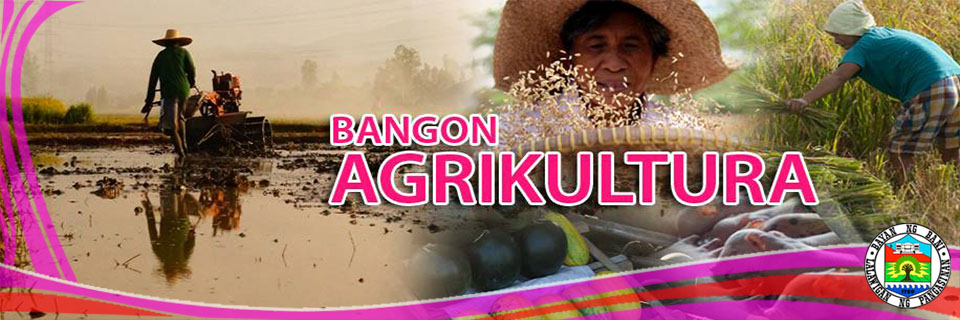
According to Soil Survey of Pangasinan, the town of Bani has five (5) types of soil which are clay, clay loam, rockland and sandy loam, which is a fissile clay like rock resembling slate, with fragile uneven laminae. Bani soils are suitable to varieties of crop production particularly palay, corn, peanut, vegetables, mango and watermelon.
The following are the types of soil in the municipality of Bani:
Bolinao Sandy Loam
This occupies the level to nearly level areas at the southern portion of Barangay Ranao and relatively small areas also located at Barangays Dacap Sur, San Simon, Centro Toma, Calabeng and Tiep. The soil is moderately deep. Generally, this soil is planted to paddy rice corn, tobacco, peanut, mongo and vegetable crop. The soil is classified as Class A, which is level to nearly level and can be cultivated safely.
Bolinao Clay Loam
This type of soil can be found in barangays Ranao, San Simon, Dacap Sur, Centro Toma, Dacap Norte, Tiep and Macabit. Generally, the areas are diked and are devoted to rice during the wet season. During dry season, however, a considerably wide area remains idle due to the absence of irrigation water. These lands are suited for intensive cultivation capacity if irrigation water is readily available. Common crops in the area can be grown successfully requiring only simple but good farm management.
It belongs to a Class BE, which is nearly level to gently sloping and none to slight erosion.
Bolinao Clay
This soil is clayish and generally shallow derived from the weathering of the shale rocks. The surface soil is very dark gray clay, 15 to 40 centimeters thick, sticky and plastic when wet. Substratum is massive layer of shale rock. This soil is located at northwest part of Barangay Dacap Norte towards Centro Toma up to Colayo. Those fishpond located in Barangays Aporao, Luac, Tugui Norte, Tugui Grande and Masidem are also having this type of soil. It is suitable for upland rice, corn and tobacco. Scattered patches of trees and shrubs and grasses could also be found in areas with this soil type.
The soil class is Class BW and can be cultivated safely that requires only simple but good farm management practices.
Shale
This soil is shallow and moderately eroded. The top soil being shallow and its slope which accelerates soil erosion when left unprotected makes this land marginally suited for seasonal cultivation. Scattered portions are planted to upland rice, corn and vegetables during wet season. These areas are best suited to permanent crops or pastures. The soil is a Class D which is good for settlements.
Rockland
This land type is composed of coralline rocks. In some places there are very thin layer of soil materials among the rocks on which some trees have taken foothold. The present vegetation should be maintained. These rocklands should never be cleared so as not to facilitate the complete washing away of the remaining soil between the rocks. These instead may be planted to permanent fruit trees as mango, casuy, sineguelas and duhat and kept under vegetative cover at all times. It is classified as a Class X soil which is wet most of the time.
Eastern part is situated a large expansion of marshy area traversed by the Bani River and a number of pond streams
Relief and Vegetation
The relief is generally level with small patches of undulating to gently rolling portions. The only depressed areas are near the Bani River, China Sea along Barangay Colayo, Centro Toma, Dacap Sur, and San Simon; and in Tambac Bay along Barangays Aporao and San Miguel, since these areas are prone to natural calamities like flooding , tidal wave and liquefaction.
On the other hand, vegetative cover consists of protection forest found in the western part of Barangays San Simon, Dacap Sur, Centro Toma and Colayo, secondary growth forest of ipil-ipil, mahogany and dike were found in Barangays Tiep, Dacap Norte, Colayo, Centro Toma, San Simon, Dacap Sur, Calabeng, Quinaoayanan, Tipor, Ballag, San Jose, Arwas, and Ranao. The mangrove forest is found in Barangay Aporao along the Tambac Bay, and grassland found in the western barangays of Dacap Sur, Centro Toma, Dacap Norte, San Simon, Ranao, Quinaoayanan, Calabeng, San Jose and Arwas. Rice and other seasonal crops were found in almost all barangays. Waterways, both freshwater and brackish water are found in the western and eastern parts of the town and built-up areas are found in each of the barangays of the municipality.
Natural Mineral Resources
Bani is endowed with natural resources like limestone, phosphate guano and shale which are located at Centro Toma, San Miguel, Garrita and Colayo. Mineral resources of the municipality include limestone, rock phosphate guano and shale. However, the municipality is basically an eco-tourism area. Predominantly it is more into promoting tourism rather than engaging in any mining activity. Mining of whatever kind is therefore prohibited in the area.
Surface Water Resource
There are numerous rivers that traverse the municipality. Bani River is the largest and widest. It starts at a spot called Don Cayo in Sorong near the old townside of Namagbagan. From there it winds its way eastward towards its mouth at Tambac Bay passing through Masidem, Tugui Norte, Luac and Aporao. Along its way, it is joined by tributaries from the southern hinterlands – The Quinaoayanan River, Ambabaay River, Banog River, Garrita River and the controversial Ilog Putot of Barangay San Miguel. From the north, it has only one tributary, the Tugui River which comes from the mountains at zigzag. And near the mouth of Bani River, the Alaminos River, going south, cuts the sitio of Abunciang from its mother barangay San Miguel. All these rivers are navigable except Ilog Putot, made by act of man. These provide water irrigation to farmers and also serve as natural drainage of the municipality. (See Map No. 9)
Man Made Risk and Natural Hazards
The municipality has no known man-made risk. All administrative facilities and other infrastructure like roads, bridges, dams, dikes were all strategically located and maintained. Even electrical post and transmitter lines are all maintained and fully planned by the NAPOCOR and PANELCO.
However, there are some portions of the town that experience slight to moderate flooding depending how strong the rain that falls during the rainy season. Barangays affected are portions of Barangays Ambabaay, Aporao, Banog Norte, Garrita, Luac, Masidem, San Miguel, Tugui Grande and Poblacion. These barangays were affected by this natural hazard due to their nearness to the river, fishponds and its physical characteristics which is low land level. Slight to moderate flooded area covers about 2,405.92 hectares.
Aside from flood problems, there are also portions which are erosion prone, which cover about 889.29 hectares. The affected barangays are portions of Tiep, Ranao, San Jose, Colayo, Dacap Sur, San Simon and Centro Toma. Erosion occurs in these areas due to deforestation and exposure of the soil to rain and excessive heat that destroys plants, trees and grasses that holds the soil.
Likewise, Barangays San Simon, Dacap Sur, Centro Toma and Colayo along the China Sea and Aporao and San Miguel by Tambac Bay area are slightly affected by liquefaction and by hazard from hydrologic adjustments and from soils, rocks and sediments movement. Likewise, there is no danger of a high intensity earthquake since the town is only traversed by a normal fault line affecting portions of upland area of Barangay Tiep, Luac and San Jose


